 |
Community Contact |
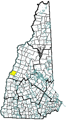
Town of Hanover
Julia N. Griffin, Town Manager
PO Box 483
Hanover, NH
03755
|
| Telephone |
(603) 643-0701 |
| Fax |
(603) 643-1720 |
| E-mail |
TownMgr@HanoverNH.org |
| Web Site |
www.hanovernh.org
|
| Municipal Office Hours |
Monday through Friday, 8:30 am - 4:30 pm
|
| County |
Grafton |
| Labor Market Area |
Lebanon NH-VT Micro-NECTA, NH Portion |
| Tourism Region |
Dartmouth-Lake Sunapee |
| Planning Commission |
Upper Valley Lake Sunapee |
| Regional Development |
Grafton County Economic Development Council
|
| Election Districts |
|
| US Congress |
District 2 |
| Executive Council |
District 1 |
| State Senate |
District 5 |
| State Representative |
Grafton County District 12 |
| Incorporated: 1761 |
| Origin: Granted in 1761, the town was named for Hanover Parish, the home parish of settlers from Lisbon, Connecticut. In 1769, Reverend Eleazar Wheelock, received a charter for a college to educate Native Americans, an expansion of the Charity School he had established in Connecticut. The college was named for William Legge, Second Earl of Dartmouth, a supporter of the Reverend's efforts. In 1771, Governor John Wentworth, upon petition from Reverend Wheelock, chartered 300 acres between Hanover and Lebanon for Dartmouth College. The land chartered to the college was for a time known as Dresden, one of 16 towns involved in a border dispute with Vermont. Today, the name Dresden is that of the local school district, a bi-state district including towns from both sides of the Connecticut River. |
| Villages and Place Names: Etna, Hanover Center, Dartmouth College |
| Population, Year of the First Census Taken: 1,380 residents in 1790 |
| Population Trends: Population change for Hanover, including resident students, totaled 3,881 over 52 years, from 7,329 in 1960 to 11,210 in 2012. The largest decennial percent change was an 18 percent increase between 1990 and 2000. The 2012 Census estimate for Hanover was 11,210 residents, which ranked 27th among New Hampshire's incorporated cities and towns. |
| Population Density and Land Area, 2010 (US Census Bureau): 229.7 persons per square mile of land area. Hanover contains 49.0 square miles of land area and 1.3 square miles of inland water area. |
| MUNICIPAL SERVICES |
| Type of Government |
Selectmen |
| Budget: Municipal Appropriations, 2013-2014 |
$24,046,755 |
| Budget: School Appropriations, 2013-2014 |
$35,171,640 |
| Zoning Ordinance |
1931/13 |
| Master Plan |
2003 |
| Capitol Improvement Plan |
Yes |
| Industrial Plans Reviewed By |
Planning Board |
| Boards and Commissions | |
| Elected: | Selectmen; Trust Funds; Library; Town Clerk; Moderator; Checklist; Assessors |
| Appointed: | Planning; Zoning; Conservation; Parks & Recreation; Finance; Affordable Housing |
| Public Library |
Howe; Hanover Town |
| EMERGENCY SERVICES |
| Police Department |
Full-time |
| Fire Department |
Municipal |
| Emergency Medical Service |
Municipal |
| Nearest Hospital(s) |
Distance |
Staffed Beds |
| Dartmouth-Hitchcock Med Ctr, Lebanon |
3 miles |
388 |
| Alice Peck Day Memorial, Lebanon |
7 miles |
25 |
|
|
|
| UTILITIES |
| Electric Supplier |
PSNH; Liberty Utilities; NH Electric Coop |
| Natural Gas Supplier |
None |
| Water Supplier |
Municipal |
| Sanitation |
Municipal |
| Municipal Wastewater Treatment Plant |
Yes |
| Solid Waste Disposal |
| Curbside Trash Pickup | Private |
| Pay-As-You-Throw Program | No |
| Recycling Program | Curbside |
| Telephone Company |
Comcast; G-4; Fairpoint |
| Cellular Telephone Access |
Yes |
| Cable Television Access |
Limited |
| Public Access Television Station |
Yes |
| High Speed Internet Service: |
| Business | Limited |
| Residential | Limited |
| (NH Dept. of Revenue Adminstration) PROPERTY TAXES |
| 2012 Total Tax Rate (per $1,000 of value) |
$17.04 |
| 2012 Equalization Ratio |
100.0 |
| 2012 Full Value Tax Rate (per $1,000 of value) |
$17.04 |
| 2012 Percent of Local Assessed Value by Property Type |
| Residential Land and Buildings | 72.9% |
| Commercial Land and Buildings | 26.4% |
| Public Utilities, Current Use, and Other | 0.7% |
| (ACS 2008-2012) HOUSING |
| Total Housing Units |
3,019 |
| Single-Family Units, Detached or Attached |
2,055 |
| Units in Multiple-Family Structures: |
|
| Two to Four Units in Structure |
281 |
| Five or More Units in Structure |
671 |
| Mobile Homes and Other Housing Units |
12 |
| (US Census Bureau) DEMOGRAPHICS |
| Total Population |
Community |
County |
| 2012 |
11,210 |
89,181 |
| 2010 |
11,260 |
89,118 |
| 2000 |
10,855 |
81,826 |
| 1990 |
9,186 |
74,998 |
| 1980 |
9,119 |
65,806 |
| 1970 |
8,494 |
54,914 |
| |
| Demographics, American Community Survey (ACS) 2008-2012 |
| Population by Gender |
| Male: 5,356 |
|
Female: 5,904 |
| Population by Age Group |
| Under age 5 |
|
373 |
| Age 5 to 19 |
|
2,943 |
| Age 20 to 34 |
|
3,829 |
| Age 35 to 54 |
|
1,955 |
| Age 55 to 64 |
|
848 |
| Age 65 and over |
|
1,312 |
| Median Age |
|
23 years |
| Educational Attainment, population 25 years and over |
| High school graduate or higher |
|
96.5% |
| Bachelor's degree or higher |
|
78.5% |
(ACS 2008-2012) ANNUAL INCOME, 2012
(Inflation Adjusted Dollars) |
| Per capita income |
$33,271 |
| Median family income |
$127,125 |
| Median household income |
$97,232 |
| Median Earnings, full-time, year-round workers |
| Male |
$84,519 |
| Female |
$63,750 |
| Individuals below the poverty level |
10.2% |
| (NHES - ELMI) LABOR FORCE |
| Annual Average |
2002 |
2012 |
| Civilian Labor Force |
5,116 |
5,616 |
| Employed |
5,001 |
5,411 |
| Unemployed |
115 |
205 |
| Unemployment Rate |
2.2% |
3.7% |
| (NHES - ELMI) EMPLOYMENT & WAGES |
| Annual Average Covered Employment |
2002 |
2012 |
| Goods Producing Industries |
| Average Employment |
1,008 |
1,261 |
| Average Weekly Wage |
$885 |
$1,190 |
| |
|
|
| Service Providing Industries |
| Average Employment |
7,267 |
7,745 |
| Average Weekly Wage |
$862 |
$1,338 |
| |
|
|
| Total Private Industry |
| Average Employment |
8,275 |
9,006 |
| Average Weekly Wage |
$865 |
$1,317 |
| |
|
|
| Government (Federal, State, and Local) |
| Average Employment |
780 |
761 |
| Average Weekly Wage |
$877 |
$1,188 |
| |
|
|
| Total, Private plus Government |
| Average Employment |
9,055 |
9,767 |
| Average Weekly Wage |
$866 |
$1,307 |
| n = indicates that the data does not meet disclosure standards |
| (NH Dept. of Education) EDUCATION/CHILD CARE FACILITIES |
| Schools students attend: |
Hanover operates grades K-5; grades 6-12 are part of Dresden Cooperative (Hanover NH and Norwich VT) |
SAU 70 |
| Career Technology Center(s): |
Hartford Area Career and Technical Center, White River Junction VT |
Region: 7 |
| Educational Facilities |
Elementary |
Middle/Junior High |
High School |
Private/Parochial |
| Number of Schools |
1 |
1 |
1 |
|
| Grade Levels |
K 1-5 |
6-8 |
9-12 |
|
| Total Enrollment |
457 |
398 |
730 |
|
| 2013 NH Licensed Child Care Facilities (Bureau of Child Care Licensing): |
Total Facilities: 9 |
Total Capacity: 342 |
| Nearest Community/Technical College: River Valley |
| Nearest Colleges or Universities: Dartmouth; Colby-Sawyer; Lebanon |
| LARGEST BUSINESSES |
PRODUCT/SERVICE |
EMPLOYEES |
ESTABLISHED |
| Dartmouth College |
Education |
3,200 |
1769 |
| Hypertherm |
Plasma arch cutting |
1,120 |
1968 |
| Dartmouth Printing Co. |
Printing services |
217 |
1938 |
| Trumbull Nelson Construction Co. |
Construction |
75 |
1917 |
| Hanover Inn |
Lodging |
112 |
1769 |
| Town of Hanover |
Municipal services |
140 |
1761 |
| Creare |
Research & development services |
83 |
1969 |
| Kendall at Hanover |
Continuing Care Retirement Community |
|
1992 |
|
|
|
|
|
|
|
|
| (Distance estimated from city/town hall) TRANSPORTATION |
| Road Access |
US Routes |
|
|
State Routes |
10, 10A, 120 |
| Nearest Interstate, Exit |
I-91 (VT), Exit 13; I-89, Exit 18 |
|
Distance |
1 mile; 5 miles |
| Railroad |
No |
| Public Transportation |
Advance Transit |
| |
| Nearest Public Use Airport, General Aviation |
| Lebanon Municipal |
| Runway |
5,496 ft. asphalt |
| Lighted? |
Yes |
Navigational Aids? |
Yes |
| Nearest Airport with Scheduled Service |
| Lebanon Municipal |
Distance |
6 miles |
| Number of Passsenger Airlines Serving Airport |
1 |
| |
| Driving distance to selected cities: |
| Manchester, NH |
75 miles |
| Portland, ME |
167 miles |
| Boston, MA |
126 miles |
| New York City, NY |
270 miles |
| Montreal, Quebec |
189 miles |
| (ACS 2008-2012) COMMUTING TO WORK |
| Workers 16 years and over |
|
| Drove alone, car/truck/van |
45.4% |
| Carpooled, car/truck/van |
6.8% |
| Public transportation |
2.3% |
| Walked |
36.4% |
| Other Means |
4.7% |
| Worked at home |
4.4% |
| Mean Travel Time to Work |
13.3 minutes |
| |
| Percent of Working Residents: |
(ACS 2008-2012) |
| Working in community of residence |
56.7% |
| Commuting to another NH community |
32.5% |
| Commuting out-of-state |
10.8% |
| RECREATION, ATTRACTIONS, AND EVENTS |
| Municipal Parks |
| YMCA/YWCA |
| Boys Club/Girls Club |
| Golf Courses |
| Swimming: Indoor Facility |
| Swimming: Outdoor Facility |
| Tennis Courts: Indoor Faclity |
| Tennis Courts: Outdoor Facility |
| Ice Skating Rink: Indoor Facility |
| Bowling Facilities |
| Museums |
| Cinemas |
| Performing Arts Facilities |
| Tourists Attractions |
| Youth Organizations (i.e., Scouts, 4-H) |
| Youth Sports: Baseball |
| Youth Sports: Soccer |
| Youth Sports: Football |
| Youth Sports: Basketball |
| Youth Sports: Hockey |
| Campgrounds |
| Fishing/Hunting |
| Boating/Marinas |
| Snowmobile Trails |
| Bicycle Trails |
| Cross Country Skiing |
| Beach or Waterfront Recreational Area |
| Overnight or Day Camps |
| |
|
|
Nearest Ski Area(s): Dartmouth Skiway |
| |
|
|
Other: Community Rowing Facility; Hood Museum of Art; Hopkins Center |
|