 |
Community Contact |
Plainfield Board of Selectmen
Steve Halleran, Town Administrator
PO Box 380
Meriden, NH
03770
|
| Telephone |
(603) 469-3201 |
| Fax |
(603) 469-3642 |
| E-mail |
plainfield.ta@plainfieldnh.org |
| Web Site |
www.plainfieldnh.org
|
| Municipal Office Hours |
Town Manager: Monday through Friday, 8 am - 4 pm; Town Clerk, Tax Collector: Monday, Tuesday, Thursday, 8 am - 4 pm, Wednesday, 8 am - 6 pm, Friday 7 am - 12 noon
|
| County |
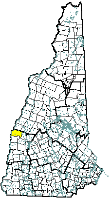
Sullivan |
| Labor Market Area |
Lebanon NH-VT Micro-NECTA, NH Portion |
| Tourism Region |
Dartmouth-Lake Sunapee |
| Planning Commission |
Upper Valley Lake Sunapee |
| Regional Development |
Capital Regional Development Council
|
| Election Districts |
|
| US Congress |
District 2 |
| Executive Council |
District 1 |
| State Senate |
District 5 |
| State Representative |
Sullivan County Districts 1, 9 |
| Incorporated: 1761 |
| Origin: Settled by a group from Plainfield, Connecticut, Plainfield is one of the towns chartered by Governor Benning Wentworth in 1761 at the beginning of the reign of King George III. A part of Plainfield with a portion of Grantham was separated into Meriden Parish in 1780. Meriden became the site of Kimball Union Academy, established in 1813. Daniel Kimball donated a large collection of books to the town for a library in 1797, along with $6,000 for a school, to which his widow added $40,000. The entire Meriden Parish was annexed to Plainfield in 1856. |
| Villages and Place Names: East Plainfield, Hell Hollow, Meriden, Mill Village, Coryville, Plainfield Village |
| Population, Year of the First Census Taken: 1,024 residents in 1790 |
| Population Trends: Population change for Plainfield totaled 1,263 over 52 years, from 1,071 in 1960 to 2,334 in 2012. The largest decennial percent change was an increase of 32 percent between 1970 and 1980, following a 24 percent increase over the previous decade. The 2012 Census estimate for Plainfield was 2,334 residents, which ranked 128th among New Hampshire's incorporated cities and towns. |
| Population Density and Land Area, 2010 (US Census Bureau): 45.3 persons per square mile of land area. Plainfield contains 52.2 square miles of land area and 0.8 square miles of inland water area. |
| MUNICIPAL SERVICES |
| Type of Government |
Selectmen |
| Budget: Municipal Appropriations, 2013 |
$21,137,280 |
| Budget: School Appropriations, 2013 |
$6,083,743 |
| Zoning Ordinance |
1959/10 |
| Master Plan |
2013 |
| Capitol Improvement Plan |
Yes |
| Industrial Plans Reviewed By |
Planning Board |
| Boards and Commissions | |
| Elected: | Selectmen; Library |
| Appointed: | Planning; Zoning; Conservation |
| Public Library |
Meriden; Philip Read Memorial |
| EMERGENCY SERVICES |
| Police Department |
Full-time |
| Fire Department |
Volunteer |
| Emergency Medical Service |
Volunteer |
| Nearest Hospital(s) |
Distance |
Staffed Beds |
| Dartmouth-Hitchcock Med Ctr, Lebanon |
13 miles |
388 |
| Alice Peck Day Memorial, Lebanon |
10 miles |
25 |
|
|
|
| UTILITIES |
| Electric Supplier |
PSNH; Granite State; NH Electric Coop |
| Natural Gas Supplier |
None |
| Water Supplier |
Plainfield/Meriden Village District |
| Sanitation |
Private septic |
| Municipal Wastewater Treatment Plant |
Yes |
| Solid Waste Disposal |
| Curbside Trash Pickup | Municipal |
| Pay-As-You-Throw Program | Yes |
| Recycling Program | Voluntary |
| Telephone Company |
Fairpoint |
| Cellular Telephone Access |
Yes |
| Cable Television Access |
Yes |
| Public Access Television Station |
No |
| High Speed Internet Service: |
| Business | Yes |
| Residential | Yes |
| (NH Dept. of Revenue Adminstration) PROPERTY TAXES |
| 2012 Total Tax Rate (per $1,000 of value) |
$24.45 |
| 2012 Equalization Ratio |
106.1 |
| 2012 Full Value Tax Rate (per $1,000 of value) |
$25.50 |
| 2012 Percent of Local Assessed Value by Property Type |
| Residential Land and Buildings | 92.1% |
| Commercial Land and Buildings | 4.4% |
| Public Utilities, Current Use, and Other | 3.5% |
| (ACS 2008-2012) HOUSING |
| Total Housing Units |
939 |
| Single-Family Units, Detached or Attached |
847 |
| Units in Multiple-Family Structures: |
|
| Two to Four Units in Structure |
22 |
| Five or More Units in Structure |
0 |
| Mobile Homes and Other Housing Units |
70 |
| (US Census Bureau) DEMOGRAPHICS |
| Total Population |
Community |
County |
| 2012 |
2,334 |
43,074 |
| 2010 |
2,364 |
43,742 |
| 2000 |
2,254 |
40,560 |
| 1990 |
2,059 |
38,652 |
| 1980 |
1,749 |
36,063 |
| 1970 |
1,323 |
30,949 |
| |
| Demographics, American Community Survey (ACS) 2008-2012 |
| Population by Gender |
| Male: 1,319 |
|
Female: 1,251 |
| Population by Age Group |
| Under age 5 |
|
106 |
| Age 5 to 19 |
|
598 |
| Age 20 to 34 |
|
286 |
| Age 35 to 54 |
|
782 |
| Age 55 to 64 |
|
467 |
| Age 65 and over |
|
331 |
| Median Age |
|
45 years |
| Educational Attainment, population 25 years and over |
| High school graduate or higher |
|
95.6% |
| Bachelor's degree or higher |
|
50.2% |
(ACS 2008-2012) ANNUAL INCOME, 2012
(Inflation Adjusted Dollars) |
| Per capita income |
$40,404 |
| Median family income |
$101,500 |
| Median household income |
$99,432 |
| Median Earnings, full-time, year-round workers |
| Male |
$57,399 |
| Female |
$50,417 |
| Individuals below the poverty level |
2.2% |
| (NHES - ELMI) LABOR FORCE |
| Annual Average |
2002 |
2012 |
| Civilian Labor Force |
1,485 |
1,559 |
| Employed |
1,454 |
1,512 |
| Unemployed |
31 |
47 |
| Unemployment Rate |
2.1% |
3.0% |
| (NHES - ELMI) EMPLOYMENT & WAGES |
| Annual Average Covered Employment |
2002 |
2012 |
| Goods Producing Industries |
| Average Employment |
85 |
86 |
| Average Weekly Wage |
$382 |
$471 |
| |
|
|
| Service Providing Industries |
| Average Employment |
283 |
300 |
| Average Weekly Wage |
$553 |
$703 |
| |
|
|
| Total Private Industry |
| Average Employment |
368 |
386 |
| Average Weekly Wage |
$513 |
$651 |
| |
|
|
| Government (Federal, State, and Local) |
| Average Employment |
32 |
35 |
| Average Weekly Wage |
$290 |
$459 |
| |
|
|
| Total, Private plus Government |
| Average Employment |
400 |
421 |
| Average Weekly Wage |
$495 |
$635 |
| n = indicates that the data does not meet disclosure standards |
| (NH Dept. of Education) EDUCATION/CHILD CARE FACILITIES |
| Schools students attend: |
Plainfield operates grades K-8; grades 9-12 are tuitioned to Lebanon |
SAU 32 |
| Career Technology Center(s): |
Hartford Area Career and Technical Center, White River Junction VT |
Region: 7 |
| Educational Facilities |
Elementary |
Middle/Junior High |
High School |
Private/Parochial |
| Number of Schools |
1 |
|
|
2 |
| Grade Levels |
K 1-8 |
|
|
1-12 |
| Total Enrollment |
231 |
|
|
337 |
| 2013 NH Licensed Child Care Facilities (Bureau of Child Care Licensing): |
Total Facilities: 3 |
Total Capacity: 34 |
| Nearest Community/Technical College: River Valley |
| Nearest Colleges or Universities: Dartmouth; Lebanon; Colby-Sawyer |
| LARGEST BUSINESSES |
PRODUCT/SERVICE |
EMPLOYEES |
ESTABLISHED |
| Kimball Union Academy |
Private school |
|
|
| North Country Door |
Cabinet, door manufacturing |
|
|
| Town Line Equipment |
Heavy equipment dealer |
|
|
| McNamara Dairy |
Glass bottle milk |
|
|
| Taylor Farm |
Maple & cheese products |
|
|
| Garfield's Smokehouse |
Smoked products |
|
|
| Edgewater Farm |
Farmstand, greenhouses, & PYO strawberries |
|
|
| Riverview Farm |
PYO apples & berries |
|
|
|
|
|
|
|
|
|
|
| (Distance estimated from city/town hall) TRANSPORTATION |
| Road Access |
US Routes |
|
|
State Routes |
12A, 120 |
| Nearest Interstate, Exit |
I-89, Exit 15 |
|
Distance |
7 miles |
| Railroad |
No |
| Public Transportation |
No |
| |
| Nearest Public Use Airport, General Aviation |
| Lebanon Municipal |
| Runway |
5,496 ft. asphalt |
| Lighted? |
Yes |
Navigational Aids? |
Yes |
| Nearest Airport with Scheduled Service |
| Lebanon Municipal |
Distance |
10 miles |
| Number of Passsenger Airlines Serving Airport |
1 |
| |
| Driving distance to selected cities: |
| Manchester, NH |
68 miles |
| Portland, ME |
153 miles |
| Boston, MA |
118 miles |
| New York City, NY |
263 miles |
| Montreal, Quebec |
192 miles |
| (ACS 2008-2012) COMMUTING TO WORK |
| Workers 16 years and over |
|
| Drove alone, car/truck/van |
82.1% |
| Carpooled, car/truck/van |
5.7% |
| Public transportation |
0.5% |
| Walked |
4.7% |
| Other Means |
1.1% |
| Worked at home |
6.0% |
| Mean Travel Time to Work |
23.0 minutes |
| |
| Percent of Working Residents: |
(ACS 2008-2012) |
| Working in community of residence |
19.4% |
| Commuting to another NH community |
68.5% |
| Commuting out-of-state |
12.1% |
| RECREATION, ATTRACTIONS, AND EVENTS |
| Municipal Parks |
| YMCA/YWCA |
| Boys Club/Girls Club |
| Golf Courses |
| Swimming: Indoor Facility |
| Swimming: Outdoor Facility |
| Tennis Courts: Indoor Faclity |
| Tennis Courts: Outdoor Facility |
| Ice Skating Rink: Indoor Facility |
| Bowling Facilities |
| Museums |
| Cinemas |
| Performing Arts Facilities |
| Tourists Attractions |
| Youth Organizations (i.e., Scouts, 4-H) |
| Youth Sports: Baseball |
| Youth Sports: Soccer |
| Youth Sports: Football |
| Youth Sports: Basketball |
| Youth Sports: Hockey |
| Campgrounds |
| Fishing/Hunting |
| Boating/Marinas |
| Snowmobile Trails |
| Bicycle Trails |
| Cross Country Skiing |
| Beach or Waterfront Recreational Area |
| Overnight or Day Camps |
| |
|
|
Nearest Ski Area(s): Mount Sunapee, Mount Ascutney (VT) |
| |
|
|
Other: Meriden Covered Bridge; Annual 4th of July Parade; Maxfield Parrish Stage Set |
|