 |
Community Contact |
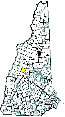
Town of Groton
Board of Selectmen
754 North Groton Road
Groton, NH
03241
|
| Telephone |
(603) 744-9190 |
| Fax |
(603) 744-3382 |
| E-mail |
selectmen@grotonnh.gov |
| Web Site |
www.grotonnh.org
|
| Municipal Office Hours |
Selectmen's Office: Monday through Thursday, 8 am - 4 pm, Friday, 8 am - 12 noon; Town Clerk, Tax Collector: Monday, Wednesday, Friday, 9 am - 4 pm, Tuesday, 5:30 pm - 7:30 pm
|
| County |
Grafton |
| Labor Market Area |
Plymouth NH LMA |
| Tourism Region |
Dartmouth-Lake Sunapee |
| Planning Commission |
North Country Council |
| Regional Development |
Grafton County Economic Development Council
|
| Election Districts |
|
| US Congress |
District 2 |
| Executive Council |
District 1 |
| State Senate |
District 2 |
| State Representative |
Grafton County Districts 6, 16 |
| Incorporated: 1761 |
| Origin: This area was named Cockermouth in 1761, after Charles Wyndham, Baron Cockermouth and Earl of Egremont, who succeeded William Pitt as Secretary of State. Few grantees took up their claims, and the land was regranted in 1766. These settlers also did not meet prescribed terms, but in 1772 Governor Wentworth renewed the charter for three years. In 1796, the town voted to change the name to Groton, and successfully petitioned the legislature to legally change the name. The name was suggested by Samuel Blood, for his hometown in Old Groton, which became a Massachusetts town when the boundary between the states was drawn in 1741. |
| Villages and Place Names: North Groton |
| Population, Year of the First Census Taken: 373 residents in 1790 |
| Population Trends: Population change for Groton totaled 492 over 52 years, from 99 in 1960 to 591 in 2012. The largest decennial percent change was a 113 percent increase between 1970 and 1980, more than doubling the population over those ten years. The 2012 Census estimate for Groton was 591 residents, which ranked 213th among New Hampshire's incorporated cities and towns. |
| Population Density and Land Area, 2010 (US Census Bureau): 14.5 persons per square mile of land area. Groton contains 40.9 square miles of land area and 0.07 square miles of inland water area. |
| MUNICIPAL SERVICES |
| Type of Government |
Selectmen |
| Budget: Municipal Appropriations, 2012 |
$751,617 |
| Budget: School Appropriations, 2011-2012 |
$813,667 |
| Zoning Ordinance |
2007 |
| Master Plan |
2007 |
| Capitol Improvement Plan |
No |
| Industrial Plans Reviewed By |
Planning Board |
| Boards and Commissions | |
| Elected: | Selectmen; Planning; Zoning, Library |
| Appointed: | Conservation |
| Public Library |
Groton Public |
| EMERGENCY SERVICES |
| Police Department |
Part-time |
| Fire Department |
Hebron - Volunteer |
| Emergency Medical Service |
Hebron - Volunteer |
| Nearest Hospital(s) |
Distance |
Staffed Beds |
| Speare Memorial, Plymouth |
13 miles |
25 |
|
|
|
|
|
|
| UTILITIES |
| Electric Supplier |
NH Electric Coop |
| Natural Gas Supplier |
None |
| Water Supplier |
Private wells |
| Sanitation |
Private septic |
| Municipal Wastewater Treatment Plant |
No |
| Solid Waste Disposal |
| Curbside Trash Pickup | None |
| Pay-As-You-Throw Program | No |
| Recycling Program | Voluntary |
| Telephone Company |
Fairpoint |
| Cellular Telephone Access |
Limited |
| Cable Television Access |
Yes |
| Public Access Television Station |
No |
| High Speed Internet Service: |
| Business | Limited |
| Residential | Limited |
| (NH Dept. of Revenue Adminstration) PROPERTY TAXES |
| 2012 Total Tax Rate (per $1,000 of value) |
$11.23 |
| 2012 Equalization Ratio |
100.0 |
| 2012 Full Value Tax Rate (per $1,000 of value) |
$12.16 |
| 2012 Percent of Local Assessed Value by Property Type |
| Residential Land and Buildings | 83.5% |
| Commercial Land and Buildings | 0.6% |
| Public Utilities, Current Use, and Other | 15.8% |
| (ACS 2008-2012) HOUSING |
| Total Housing Units |
473 |
| Single-Family Units, Detached or Attached |
353 |
| Units in Multiple-Family Structures: |
|
| Two to Four Units in Structure |
0 |
| Five or More Units in Structure |
0 |
| Mobile Homes and Other Housing Units |
120 |
| (US Census Bureau) DEMOGRAPHICS |
| Total Population |
Community |
County |
| 2012 |
591 |
89,181 |
| 2010 |
593 |
89,118 |
| 2000 |
458 |
81,826 |
| 1990 |
318 |
74,998 |
| 1980 |
255 |
65,806 |
| 1970 |
120 |
54,914 |
| |
| Demographics, American Community Survey (ACS) 2008-2012 |
| Population by Gender |
| Male: 286 |
|
Female: 236 |
| Population by Age Group |
| Under age 5 |
|
6 |
| Age 5 to 19 |
|
86 |
| Age 20 to 34 |
|
41 |
| Age 35 to 54 |
|
197 |
| Age 55 to 64 |
|
74 |
| Age 65 and over |
|
118 |
| Median Age |
|
51 years |
| Educational Attainment, population 25 years and over |
| High school graduate or higher |
|
75.1% |
| Bachelor's degree or higher |
|
14.0% |
(ACS 2008-2012) ANNUAL INCOME, 2012
(Inflation Adjusted Dollars) |
| Per capita income |
$23,614 |
| Median family income |
$63,500 |
| Median household income |
$37,361 |
| Median Earnings, full-time, year-round workers |
| Male |
$38,125 |
| Female |
$32,125 |
| Individuals below the poverty level |
9.6% |
| (NHES - ELMI) LABOR FORCE |
| Annual Average |
2002 |
2012 |
| Civilian Labor Force |
236 |
270 |
| Employed |
227 |
259 |
| Unemployed |
9 |
11 |
| Unemployment Rate |
3.8% |
4.1% |
| (NHES - ELMI) EMPLOYMENT & WAGES |
| Annual Average Covered Employment |
2002 |
2012 |
| Goods Producing Industries |
| Average Employment |
n |
0 |
| Average Weekly Wage |
n |
$0 |
| |
|
|
| Service Providing Industries |
| Average Employment |
n |
n |
| Average Weekly Wage |
n |
n |
| |
|
|
| Total Private Industry |
| Average Employment |
13 |
n |
| Average Weekly Wage |
$471 |
n |
| |
|
|
| Government (Federal, State, and Local) |
| Average Employment |
19 |
18 |
| Average Weekly Wage |
$115 |
$223 |
| |
|
|
| Total, Private plus Government |
| Average Employment |
32 |
n |
| Average Weekly Wage |
$260 |
n |
| n = indicates that the data does not meet disclosure standards |
| (NH Dept. of Education) EDUCATION/CHILD CARE FACILITIES |
| Schools students attend: |
Grades K-12 are part of Newfound Area (Alexandria, Bridgewater, Bristol, Danbury, Groton, Hebron, New Hampton) |
SAU 4 |
| Career Technology Center(s): |
Plymouth Applied Technology Center |
Region: 5 |
| Educational Facilities |
Elementary |
Middle/Junior High |
High School |
Private/Parochial |
| Number of Schools |
|
|
|
|
| Grade Levels |
|
|
|
|
| Total Enrollment |
|
|
|
|
| 2013 NH Licensed Child Care Facilities (Bureau of Child Care Licensing): |
Total Facilities: 0 |
Total Capacity: 0 |
| Nearest Community/Technical College: Lakes Region |
| Nearest Colleges or Universities: Plymouth State University |
| LARGEST BUSINESSES |
PRODUCT/SERVICE |
EMPLOYEES |
ESTABLISHED |
| TLC Tree & Crane Service |
Tree care |
5 |
1980 |
| Gordon Coursey & Sons LLC |
Logging, land clearing, log home building, custom building |
6 |
1975 |
| Maxam |
Dynamite/explosives |
6 |
2008 |
| Groton Wind LLC (Iberdrola Renewables) |
Industrial wind turbines |
6 |
2012 |
|
|
|
|
|
|
|
|
|
|
|
|
|
|
|
|
|
|
|
|
|
|
|
|
| (Distance estimated from city/town hall) TRANSPORTATION |
| Road Access |
US Routes |
|
|
State Routes |
|
| Nearest Interstate, Exit |
I-93, Exit 26 |
|
Distance |
13 miles |
| Railroad |
No |
| Public Transportation |
No |
| |
| Nearest Public Use Airport, General Aviation |
| Plymouth Regional |
| Runway |
2,380 ft. turf |
| Lighted? |
No |
Navigational Aids? |
No |
| Nearest Airport with Scheduled Service |
| Lebanon Municipal |
Distance |
36 miles |
| Number of Passsenger Airlines Serving Airport |
1 |
| |
| Driving distance to selected cities: |
| Manchester, NH |
73 miles |
| Portland, ME |
114 miles |
| Boston, MA |
124 miles |
| New York City, NY |
301 miles |
| Montreal, Quebec |
213 miles |
| (ACS 2008-2012) COMMUTING TO WORK |
| Workers 16 years and over |
|
| Drove alone, car/truck/van |
79.7% |
| Carpooled, car/truck/van |
4.1% |
| Public transportation |
0.0% |
| Walked |
0.0% |
| Other Means |
0.0% |
| Worked at home |
16.2% |
| Mean Travel Time to Work |
30.9 minutes |
| |
| Percent of Working Residents: |
(ACS 2008-2012) |
| Working in community of residence |
17.8% |
| Commuting to another NH community |
81.4% |
| Commuting out-of-state |
0.8% |
| RECREATION, ATTRACTIONS, AND EVENTS |
| Municipal Parks |
| YMCA/YWCA |
| Boys Club/Girls Club |
| Golf Courses |
| Swimming: Indoor Facility |
| Swimming: Outdoor Facility |
| Tennis Courts: Indoor Faclity |
| Tennis Courts: Outdoor Facility |
| Ice Skating Rink: Indoor Facility |
| Bowling Facilities |
| Museums |
| Cinemas |
| Performing Arts Facilities |
| Tourists Attractions |
| Youth Organizations (i.e., Scouts, 4-H) |
| Youth Sports: Baseball |
| Youth Sports: Soccer |
| Youth Sports: Football |
| Youth Sports: Basketball |
| Youth Sports: Hockey |
| Campgrounds |
| Fishing/Hunting |
| Boating/Marinas |
| Snowmobile Trails |
| Bicycle Trails |
| Cross Country Skiing |
| Beach or Waterfront Recreational Area |
| Overnight or Day Camps |
| |
|
|
Nearest Ski Area(s): Tenney Mountain |
| |
|
|
Other: Mary Baker Eddy Historic House; Sculptured Rocks Natural Area; N Groton School house |
|